
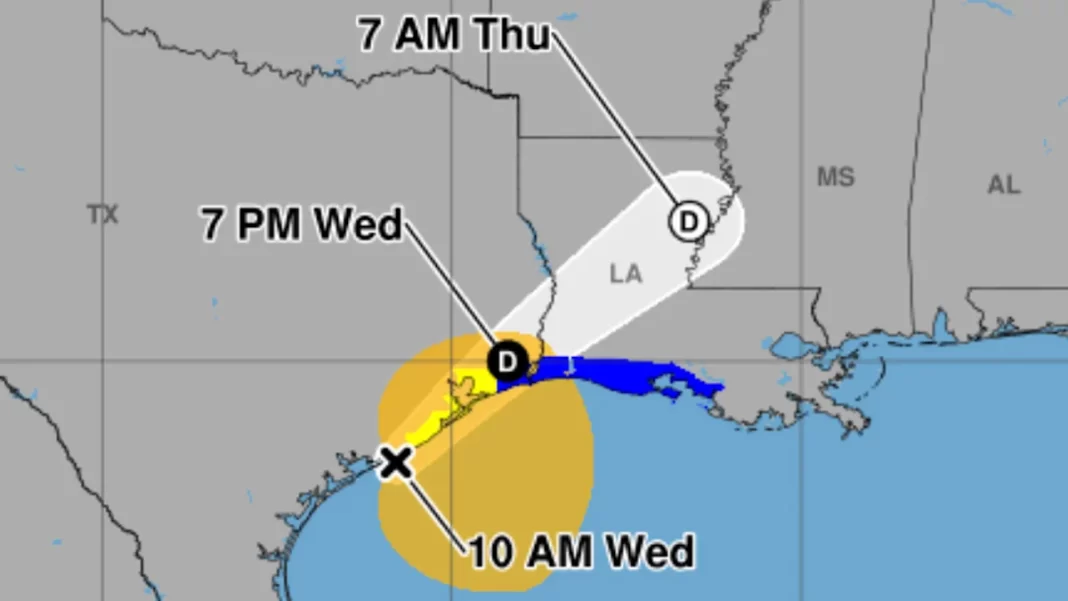

Tropical Storm Arthur has formed along the middle of the Texas coast and is expected to bring torrential rain and the possibility of “life-threatening flash flooding” across parts of the Southeast, the National Hurricane Center said on Wednesday.
It is the first named storm of the 2026 Atlantic hurricane season.
Arthur is “expected to produce rainfall totals of 5 to 10 inches, with isolated higher totals near 20 inches” from the mid- and upper-Texas coast to southern and central portions of Louisiana, Mississippi and Alabama, as well as western Georgia and the Florida Panhandle, through early Friday, NHC forecasters said.
Where is Arthur now, and what is its path?
As of 5 p.m. ET on Wednesday:
The storm was located about 20 miles north-northwest of Matagorda, Texas, and about 195 miles west-southwest of Lake Charles, La.
It has maximum sustained winds of 45 mph.
The system is moving north-northeast at 7 mph.
The center of the storm is expected to move farther inland over southeastern Texas on Wednesday night. “Weakening is expected as the low moves farther inland, and it could dissipate by tonight or early Thursday,” the NHC said.
Watches and warnings
A tropical storm warning is in effect for:
Sargent, Texas, to Morgan City, La.
This means that tropical storm conditions are expected within 12 to 24 hours.
How will it impact the World Cup?
Officials with FIFA have been monitoring the storm and its potential impacts for the ongoing World Cup, including an upcoming match in Atlanta.
There is a flood watch in Atlanta, where on Thursday Czech Republic and South Africa are scheduled to play at Mercedes-Benz Stadium, temporarily rebranded as Atlanta Stadium, at noon.
“Multiple rounds of heavy rainfall are expected over the area Thursday into Friday,” the National Weather Service said. “Widespread rainfall amounts of 2 to 4 inches are forecast, with locally higher amounts possible.”
On Sunday night, severe weather in the Atlanta area forced the cancellation of FIFA’s Fan Festival.